Monday, May 27, 2013

Memorial Day Weekend Roadtrip

Still too much snow to link up good rides around home, so I packed up the dog and the bike last Wednesday and went west again. I didn't stop in Fruita this time, or Moab, or St. George or Hurricane although I was very tempted. This time I kept on going until I hit the ocean. My buddy lives right on Pacific Beach in San Diego so I went to visit him and check out some Southern California singletrack.

After sleeping briefly on the side of I-15, I got to his place early Thursday morning. I took my pup to Dog  Beach and laughed uncontrollably as he learned from the other dogs how to swim in the surf. Before long he was crashing into the waves and stealing all the tennis balls like an old pro.

My friend and I rode Thursday and Friday at little canyons right in the middle of San Diego. We got some miles in and it was fun, but Saturday was the real deal. Saturday morning we both drove out to set up a shuttle on the legendary Noble Canyon ride in the mountains.

Noble Canyon started with a small climb among the shady pines, crossed through a burn area, then got deep down into the shady canyon. Parts of upper sections deep in the shady canyon are some seriously worthy riding. The trail becomes more consistently technical as you drop into the lower desert sections. Then after a sandy 300-400' climb, Noble Canyon finishes with another combo swoopy/technical downhill finish.

We had parked our shuttle car at the grocery store in Pine Valley, so we had a few miles of road riding to get back there. Total ride was about 14 miles.

I headed back towards Colorado at that point with a vague plan for the next two days before returning to work on Tuesday. I thought I might ride in Flagstaff, but when I got there I wasn't tired yet so I kept on going towards Colorado and Phil's World.

I slept a few hours aside the interstate in far eastern Arizona, but I was back on the road as soon as the sun rose. I was pretty tired, but extremely excited to ride Phil's World after everything I have read and heard about it over the years.

Phil's World is one of these rare places like 18 Road in Fruita & Mcoy Flats in Vernal, where locals riders have taken matters into their own hands and designed and built MTB-specific trails on BLM land that would otherwise sit idle.

I was road-weary, malnourished, and just plain tired when I started my ride at Phil's World, but that lasted maybe five minutes. The loop started out super-fun, but it just kept getting better and better. The flow of the trails was beyond exceptional. I'm already looking forward to bringing my friends here and watching their faces contort with sheer joy. Thank you Phil's World, thank you Cortez trailbuilders. My loop was 21 miles in exactly 2 hours. What a Ride!

I debated hanging in the area for another day and sampling some Durango trails, but the road warrior mentality set in and I decided to push on back to Frisco. I got home at midnight and slept all the way through until noon on Memorial Day. Then I ate lunch, watched some TV, and took a nap.

Finally I dragged my ass up and took my first Summit County mountain bike ride of 2013. Most everything up high is still snowed-in, but not the Frisco Peninsula. And the Perimeter Trail on the Peninsula is actually very fun. I never ride it once the higher trails are clear, but I should. It is such a change from the typical, and necessary, long grunt climb to be followed by amazing stellar descent that is usually required in Summit County.

And the Peninsula reminded me of another thing I've been taught over and over, yet still try to deny when I'm weary. Singletrack trails are fun, always. It doesn't matter how tired you are or whether you think you've ridden hard the last few days and should maybe just chill.

Get your shit together and ride. Start slowly. Just head out and the Trail Warrior will take over from there.

(On a quick note, this is probably the longest roadtrip I've undertaken in such a short time. It taught me that I can cover the miles and still easily hit the rides and other activities that surrounded me. It changed my perspective for my future roadtrip planning. Total: 5 days, 6 states, 2300 miles, 5 MTB trails, 4 Beach trips, and a few other hours of  Pacific Beach nightlife.)

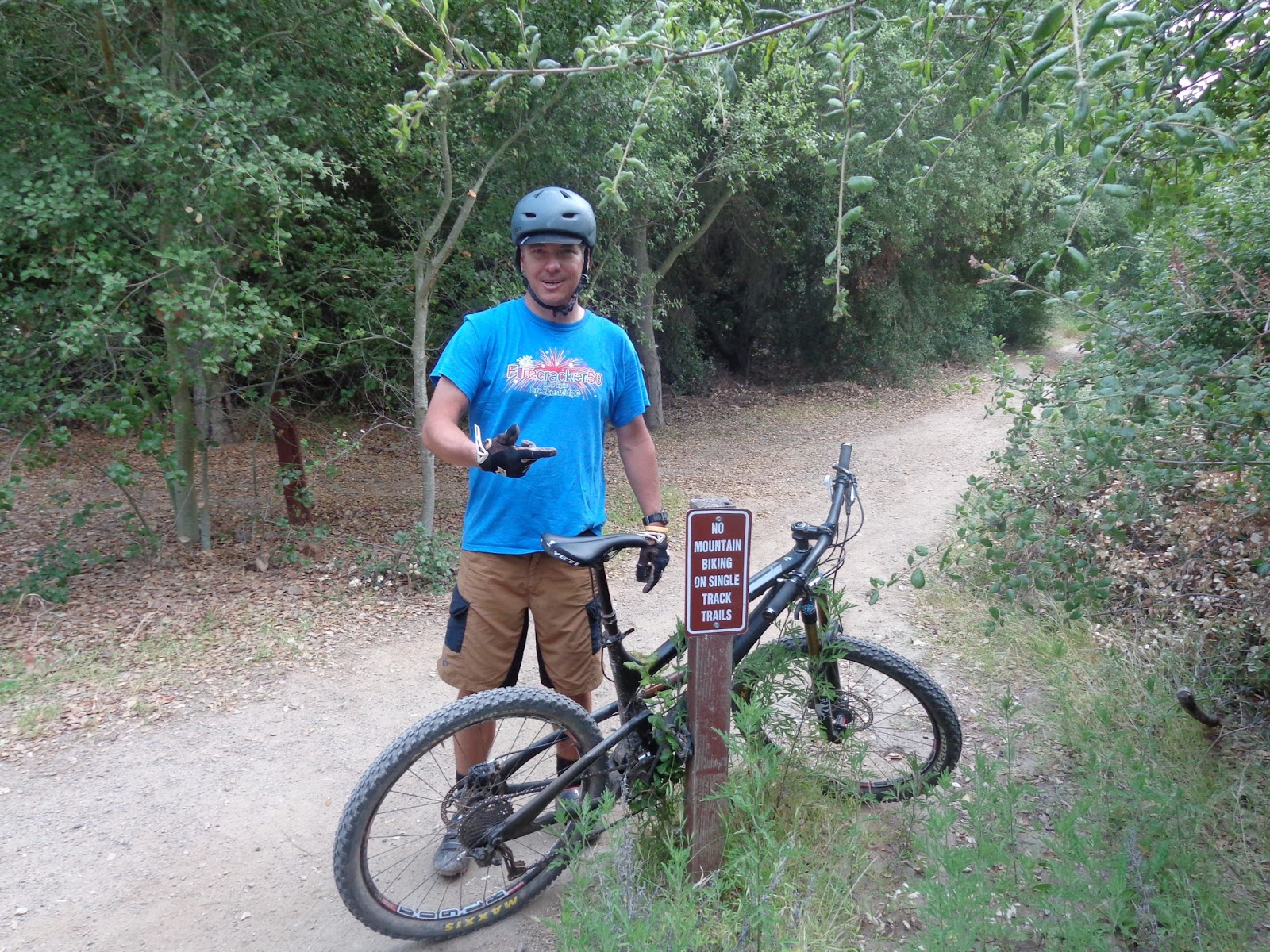
Here's a photo of the inside San Diego trails....


Tuesday, May 14, 2013

Moab 2013

The annual post-Loveland-closing Moab trip went down last Wed-Monday. I told myself I would ride a lot, try not to drink tooooooo much, and to maybe eat as healthy as I could while camping. Well... I rode quite a bit, so 1 out of 3 a'int bad...

Woke up in Fruita Thursday morning. The rain had let off during the night, so I packed up and headed over to the Kokopelli trailhead and was riding by 9am. My legs were horribly sore from hiking yesterday, so I knocked out an almost 20-mile loop of easy stuff: Rustler's Loop to Mary's Loop to Horsethief Bench to Steve & Handcuff's Loop.

Good stuff; finished up and drove on Moab, and it was early afternoon when I arrived.

Our plan was to camp at a super-secret spot on the Porcupine Rim overlooking Castle Valley. Leaving Moab and heading up Sand Flats Road, the weather looked nasty up there. We almost punted to something else, but I am so happy we went up because we were rewarded with this:


So that was our back porch for the next 4 days.

On Friday morning, we got up early and set-up our return shuttle back to camp. Then we grabbed Coyote Shuttle which took us up as high as they allowed and we started the ride on the Upper Porcupine Singletrack. We semi-leisurely took the various Lower Enchilada routes all the way down to the Colorado River 4000 feet below. So got in almost 19 miles of very technical terrain that day.

Saturday was time to get acquainted with the brand new Captain Ahab trail. It was hot and we seemed to be dragging from the previous nights festivities. During the climb up Amasa Back, one of us who was not me found time to huck this:


Captain Ahab was a real treat. There is still plenty of technical climbing once you reach Ahab, so don't be expecting a long descent until you've really earned it. But once the trail went down in earnest, it was ON! Lots of the normal Moab techy-drops, but nearly every one had a sweet line built through it. Still, with the 6 of us, it turned into a long day @ 7.5 miles in 2 hours...., yes, hours.

Some of the bikes were getting thrashed and leaking oily shit where it shouldn't, so our team was cut in half for Sunday. We decided on some "intermediate" & "flowy" singletrack called the Moab Brand Trails. Good times, nice to knock out a few singletrack miles without having to concentrate on not dying all the time. We did almost 16 miles in about 2 hours and 45 minutes.

Monday was the last day, so we settled on a semi-repeat route that we could ride from camp. And right as we were preparing to ride off, we were greeted with a very curious, spectacular, and spiritual sight:


Yeah, Moab Macaws.

You figure it out. We took it as a blessing and went on to finish the trip with an UPS > LPS > Sand Flats Road > Upper LPS route that came in at exactly 15 miles.

Nice trip. I did ride every day. Drank and partied more than enough too, but so be it. Way too much fun with my friends and that will always be more important than training and racing.

Wednesday, May 8, 2013

Colorado National Monument

The ski area closed on Sunday, so as soon as I finished wrapping up a few important things on Tuesday, I packed up and headed West again to try and get dry and warm in the desert for a few days.

I got a room in Fruita while I wait for a couple friends to come through town on Thursday and we will head on to Moab for some riding out there. When I woke up this morning, it was very rainy and it didn't look like there was much hope for it to dry up enough to get a ride in. I couldn't just lay around in the dumpy motel though, so I decided to get out the rain gear and head over to Colorado National Monument for a good hike.

I checked the map for a challenging route before deciding to drive over to the lower trailhead of Ute Canyon and the Liberty Cap trails for a possible big loop. The Ute Canyon trail was listed on the map as "unmaintained ," so I decided to head up that first in case it was difficult and slow-going. After immediately climbing up about 700', the trail calmed down and followed the dry creekbed deep into the impressive Ute Canyon.


Ute Canyon

The trail was in good shape the whole way so it wasn't long before I was climbing out the steep trail towards Rim Rock Drive. I reached the Rim after 5 miles and did another map check. 

My options were to turn around and head back out the same way, or to jog west an unknown number of miles to link up with the Upper Liberty Cap trailhead for a loop back down to the truck. I used my Snickers wrapper to scientifically measure the distance to the other trailhead, and I guesstimated it would be about 4 miles. Then it would be 7 miles back down the Liberty Cap trail for a total of about 16 miles. I felt good enough for that so I started slowly jogging down the road.

To my surprise, I reached the upper trailhead after exactly 3 miles, so it wasn't as far as I thought it would be.

The Upper Liberty Cap trail was "maintained" so it was wider and even easier to follow than the Ute Canyon trail. The first 5 miles were very gently rolling terrain that would take me to the ancient Liberty Cap before a steep plunge off the rim and back to the truck.

Along the way I got big views of Fruita off the the top:


I kept up the slow jogging all the way and made it to the Liberty Cap in quick time after 5 miles.


The hike down the cliffs from Liberty Cap was the most fun trail on the hike. The trail traversed back-and-forth along the cliff edges until it would find a narrow place to scoot down. My legs were getting pretty sore, so I dialed it back a bit, but I made it back down to the truck fine and took the pic below looking back up to the Liberty Cap.


I paced around the parking lot for about a minute until I could make the GPS read exactly 15 miles in 3 hours and 45 minutes total time. Looks like a total of about 2300' climbing.

That's the longest hike / jog I've done in a few months and my legs were pretty sore when I reached the motel. I took a solid 3-hour nap and they've loosened back up considerably. It never did rain during the hike, so maybe the bike trails are dried up enough for a ride in the morning. I'll be heading to Moab around 1pm so as long as it doesn't rain more tonight, I'll be packing out of the motel early and giving the Kokopelli singletrack another look.

Great hike / jog. Started the trip off with a solid workout.

Thursday, May 2, 2013

April Wrap-up

Pretty good month. Even though it won't stop snowing in the high country, I still got enough done to reach most of my goals.

I lost somewhere between 5.5 & 7.5 pounds during the month. I weighed 173.6 yesterday, but then 175.4 this morning, so not sure how much I lost exactly, but I'll take it.

I did some kind of workout on 26 of 30 days during the month.

  • Skinned at least 1000 vertical feet on 9 days.
  • Skied semi-hard 11 days.
  • Hiked or Jogged 22 days for a total of 114.5 miles
  • Mountain biked 6 days for a total of 210.5 miles
  • Total vertical climbing of 32,775 feet.
  • Got back to lifting weights towards the end of the month for 3 days.
  • Foundation back exercises on 5 days.
  • Total of 67 hours of exercise during the month, although a decent amount was low intensity hiking.

I put together my May goals yesterday:
  • Get back under 170 pounds, hopefully to 168-ish by the 31st.
  • At least 16 days on the bike & getting started on the intervals.
  • 20+ days hiking, jogging, climbing, skinning since I have to walk the Border Collie anyways.
  • 17 days of Foundation back / core exercises.
  • 12 days lifting weights.
  • 400+ bike miles
  • 100+ feet miles
  • 40,000'+ vert of climbing combined.
In other news, the decision came down to use the Tarryall Detour during the CTR instead of Highway 285. I'm very excited even though this adds 50+ miles of hilly forest roads to the total length of the race. I just much prefer this route than sharing 285 with truckers and RV's on a small shoulder. But we'll see how I feel when I have to make that turn-off knowing it will take me many more hours to reach Kenosha Pass.

The vote was overwhelmingly in favor of the Tarryall Detour, which amazes me since the main field will be travelling Eastbound this year, and would have been able to cruise downhill on 285 to Bailey in a very quick time. The fact that Tarryall was chosen seems an even greater indictment of the suck-factor on 285. I'm happy and relieved that I don't have to worry about it anymore.

here's some Zippety Do Dah @ Fruita: